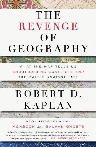
The Revenge of Geography: What the Map Tells Us About Coming Conflicts and the Battle Against Fate
About this book
The book opens from Kaplan's reporting in conflict zones and from a reaction against the idea that globalization made maps less important. Mountains, plains, river systems, coastlines, and resource access shape costs and opportunities even when they do not determine decisions.
Kaplan reads writers including Halford Mackinder and Nicholas Spykman, while confronting the misuse of geopolitics by imperial and Nazi thinkers. He then applies geographic frameworks to Europe, Russia, China, India, Iran, Turkey, and the wider Middle East.
The method emphasizes constraints that political ideals can overlook, but it can also risk making contingent choices appear inevitable. Kaplan repeatedly presents geography as a starting point for strategy rather than an excuse that removes human agency.
The Revenge of Geography is a survey of geopolitical thought and a regional forecast of Eurasian conflict. It is most useful as one lens among political, economic, and historical explanations, not a complete theory of state behavior.
Read a sample
5,015 words
Plain text
From the opening
Preface
FRONTIERS
A good place to understand the present, and to ask questions about the future, is on the ground, traveling as slowly as possible.
As the first rank of domed hills appeared on the horizon, rippling upward from the desert floor in northern Iraq, to culminate in ten-thousand-foot massifs clothed in oak and mountain ash, my Kurdish driver glanced back at the vast piecrust plain, sucked his tongue in contempt, and said, “Arabistan.” Then, looking toward the hills, he murmured, “Kurdistan,” and his face lit up. It was 1986, the pinnacle of Saddam Hussein’s suffocating reign, and yet as soon as we penetrated further into prisonlike valleys and forbidding chasms, the ubiquitous billboard pictures of Saddam suddenly vanished. So did Iraqi soldiers. Replacing them were Kurdish peshmergas with bandoliers, wearing turbans, baggy trousers, and cummerbunds. According to the political map, we had never left Iraq. But the mountains had declared a limit to Saddam’s rule—a limit overcome by the most extreme of measures.
In the late 1980s, enraged at the freedom that these mountains had over the decades and centuries ultimately granted the Kurds, Saddam launched a full-scale assault on Iraqi Kurdistan—the infamous Al-Anfal campaign—that killed an estimated 100,000 civilians. The mountains were clearly not determinative. But they did serve as the backdrop—the original fact—to this tragic drama. It is because of the mountains that Kurdistan has to a significant extent now effectively seceded from the Iraqi state.
Mountains are a conservative force, often protecting within their defiles indigenous cultures against the fierce modernizing ideologies that have too often plagued the flatlands, even as they have provided refuge for Marxist guerrillas and drug cartels in our own era.1 The Yale anthropologist James C. Scott writes that “hill peoples are best understood as runaway, fugitive, maroon communities who have, over the course of two millennia, been fleeing the oppressions of state-making projects in the valleys.”2 For it was on the plain where the Stalinist regime of Nicolae Ceausescu really sank its teeth into the population. Ascending the Carpathians several times in the 1980s, I saw few signs of collectivization. These mountains that declare Central Europe’s rear door were defined more by wood and natural stone dwellings than by concrete and scrap iron, favorite material elements of Romanian communism.
The Carpathians that girdle Romania are no less a border than the mountains of Kurdistan. Entering the Carpathians from the west, from the threadbare and majestically vacant Hungarian Puszta, marked by coal-black soil and oceans of lemon-green grass, I began to leave the European world of the former Austro-Hungarian Empire and to gradually make my way into the economically more deprived terrain of the former Ottoman Turkish Empire. Ceausescu’s oriental despotism, so much more oppressive than Hungary’s haphazard goulash communism, was, ultimately, made possible by the ramparts of the Carpathians.
And yet the Carpathians were not impenetrable. For centuries traders had thrived in their many passes, the bearers of goods and high culture so that a poignant semblance of Central Europe could take root well beyond them, in cities and towns like Bucharest and Ruse. But the mountains did constitute an undeniable gradation, the first in a series in an easterly direction, that would conclude finally in the Arabian and Kara Kum deserts.
In 1999, I took a freighter overnight from the Azerbaijani capital of Baku, on the western shore of the Caspian Sea, to Krasnovodsk in Turkmenistan, on the eastern shore, the beginning of what the Sassanid Persians in the third century A.D. called Turkestan. I awoke to a spare, abstract shoreline: whitish hutments against cliffs the clay color of death. All the passengers were ordered to line up in single file in the 100-degree temperature before a peeling gate where a lone policeman checked our passports. We then passed into a bare, broiling shed, where another policeman, finding my Pepto-Bismol tablets, accused me of smuggling narcotics. He took my flashlight and emptied the 1.5-volt batteries onto the dirt floor. His expression was as bleak and untamed as the landscape. The town that beckoned beyond the shed was shadeless and depressingly horizontal, with little architectural hint of a material culture. I suddenly felt nostalgia for Baku, with its twelfth-century Persian walls and dream palaces built by the first oil barons, embellished with friezes and gargoyles, a veneer of the West that despite the Carpathians, the Black Sea, and the high Caucasus, refused to completely die out. Traveling eastward, Europe had evaporated in stages before my eyes, and the natural border of the Caspian Sea had indicated the last stage, heralding the Kara Kum Desert.
Of course, geography does not demonstrate Turkmenistan’s hopelessness. Rather, it signifies only the beginning of wisdom in the search for a historical pattern: one of repeated invasions by Parthians, Mongols, Persians, czarist Russians, Soviets, and a plethora of Turkic tribes against a naked and unprotected landscape. There was the barest existence of a civilization because none was allowed to permanently sink deep roots, and this helps explain my first impressions of the place.
The earth heaved upward, and what had moments before seemed like a unitary sandstone mass disintegrated into a labyrinth of scooped-out riverbeds and folds reflecting gray and khaki hues. Topping each hill was a slash of red or ocher as the sun caught a higher, steeper slope at a different angle. Lifts of cooler air penetrated the bus—my first fresh taste of the mountains after the gauzy heat film of Peshawar in Pakistan’s North-West Frontier Province.3 By themselves, the dimensions of the Khyber Pass are not impressive. The highest peak is under seven thousand feet and the rise is rarely steep. Nevertheless, in under an hour in 1987, I was transported through a confined, volcanic netherworld of crags and winding canyons; from the lush, tropical floor of the Indian Subcontinent to the cool, tonsured wastes of middle Asia; from a world of black soil, bold fabrics, and rich, spicy cuisine to one of sand, coarse wool, and goat meat.
Continue reading the sampleClose the sample
But like the Carpathians, whose passes were penetrated by traders, geography on the Afghanistan-Pakistan border has different lessons to offer: for what the British were the first to call the “North-West Frontier” was “historically no frontier at all,” according to Harvard professor Sugata Bose, “but the ‘heart’ ” of an “Indo-Persian” and “Indo-Islamic” continuum, the reason why Afghanistan and Pakistan form an organic whole, contributing to their geographical incoherence as separate states.4
Then there were borders more artificial still:
I crossed the Berlin Wall into East Berlin twice, in 1973 and in 1981. The twelve-foot-high concrete curtain, topped by a broad pipe, cut through a filmy black-and-white landscape of poor Turkish and Yugoslav immigrant neighborhoods on the West German side, and deserted and World War II–scarred buildings on the East German one. You could walk up and touch the Wall almost anywhere on the western side, where the graffiti was; the minefields and guard towers all lay to the east.
As surreal as this prison yard of an urban terrain appeared at the time, one didn’t question it except in moral terms, for the paramount assumption of the age was that the Cold War had no end. Particularly for those like myself, who had grown up during the Cold War but had no memory whatsoever of World War II, the Wall, however brutal and arbitrary, seemed as permanent as a mountain range. The truth only emerged from books and historical maps of Germany that I had, entirely by coincidence, begun to consult during the first months of 1989, while in Bonn on a magazine assignment. The books and maps told a story:
Occupying the heart of Europe between the North and Baltic seas and the Alps, the Germans, according to the historian Golo Mann, have always been a dynamic force locked up in a “big prison,” wanting to break out. But with the north and south blocked by water and mountains, outward meant east and west, where there was no geographical impediment. “What has characterized the German nature for a hundred years is its lack of form, its unreliability,” writes Mann, referring to the turbulent period from the 1860s to the 1960s, marked by Otto von Bismarck’s expansion and the two world wars.5 But the same could also be said for Germany’s size and shape on the map throughout its history.
Indeed, the First Reich, founded by Charlemagne in 800, was a great shifting blob of territory that, at one time or another, encompassed Austria and parts of Switzerland, France, Belgium, the Netherlands, Poland, Italy, and Yugoslavia. Europe seemed destined to be ruled from what now corresponds with Germany. But then came Martin Luther, who split Western Christianity with the Reformation, which, in turn, ignited the Thirty Years’ War, fought primarily on German soil. Hence, Central Europe was ravished. The more I read—about the eighteenth-century dualism between Prussia and Habsburg Austria, about the early-nineteenth-century tariff union between the various German states, and Bismarck’s late-nineteenth-century Prussian-based unification—the more it became apparent that the Berlin Wall was just another stage in this continuing process of territorial transformation.
The regimes that had fallen soon after the Berlin Wall did—in Czechoslovakia, Hungary, Romania, Bulgaria, and elsewhere—were ones I had known intimately through work and travel. Up close they had seemed so impregnable, so fear-inducing. Their abrupt unraveling was a signal lesson for me, not only about the underlying instability of all dictatorships, but about how the present, as permanent and overwhelming as it can seem, is fleeting. The only thing enduring is a people’s position on the map. Thus, in times of upheaval maps rise in importance. With the political ground shifting rapidly under one’s feet, the map, though not determinitive, is the beginning of discerning a historical logic about what might come next.
Violence was the reigning impression of the demilitarized zone (DMZ) between the two Koreas. In 2006, I saw South Korean soldiers standing frozen in tae kwon do–ready positions, their fists and forearms clenched, staring into the faces of their North Korean counterparts. Each side picked its tallest, most intimidating soldiers for the task. But the formalized hatred on display in the midst of barbed wire and minefields will probably be consigned to history on some foreseeable morrow. When you look at other divided-country scenarios in the twentieth century—Germany, Vietnam, Yemen—it is apparent that however long the division persisted, the forces of unity ultimately triumph, in an unplanned, sometimes violent and fast-moving fashion. The DMZ, like the Berlin Wall, is an arbitrary border of no geographical logic that divides an ethnic nation at the spot where two opposing armies happened to come to rest. Just as Germany was reunited, we might expect, or at least should plan for, a united Greater Korea. Again, the forces of culture and geography are likely to prevail at some point. A man-made border that does not match a natural frontier zone is particularly vulnerable.
I crossed, too, the land borders from Jordan to Israel and from Mexico to the United States: more on those borders and others later. For I now wish to take another journey—of a radically different sort—through selected pages of history and political science that have survived across the chasm of the decades and, in some cases, the centuries, and on account of their emphasis on geography allow us to read the relief map better, and with that, help us glimpse, however vaguely, the contours of future politics. For it was the very act of crossing so many frontiers that made me intensely curious about the fate of the places through which I had passed.
My reporting over three decades has convinced me that we all need to recover a sensibility about time and space that has been lost in the jet and information ages, when elite molders of public opinion dash across oceans and continents in hours, something which allows them to talk glibly about what the distinguished New York Times columnist Thomas L. Friedman has labeled a flat world. Instead, I will introduce readers to a group of decidedly unfashionable thinkers, who push up hard against the notion that geography no longer matters. I will lay out their thinking in some depth in the first half of this journey in order to apply their wisdom in the second half, as to what has happened and is likely to happen across Eurasia—from Europe to China, including the Greater Middle East and the Indian Subcontinent. To find out what it is exactly that has been lost in our view of physical reality, to discover how we lost it, and then to restore it by slowing down our pace of travel and of observation itself—by way of the rich erudition of now deceased scholars: that is the goal of this journey.
Geography, from a Greek word that means essentially a “description of the earth,” has often been associated with fatalism and therefore stigmatized: for to think geographically is to limit human choice, it is said. But in engaging with such tools as relief maps and population studies I merely want to add another layer of complexity to conventional foreign policy analyses, and thus find a deeper and more powerful way to look at the world. You do not have to be a geographical determinist to realize that geography is vitally important. The more we remain preoccupied with current events, the more that individuals and their choices matter; but the more we look out over the span of the centuries, the more that geography plays a role.
The Middle East is a case in point.
As I write, the region from Morocco to Afghanistan is in the midst of a crisis of central authority. The old order of autocracies has become untenable, even as the path toward stable democratization is tortuous. The first phase of this great upheaval has featured the defeat of geography through the power of new communications technologies. Satellite television and social networking Internet sites have created a single community of protesters throughout the Arab world: so that democracy advocates in such disparate places as Egypt and Yemen and Bahrain are inspired by what has begun in Tunisia. Thus, there exists a commonality in the political situations of all these countries. But as the revolt has gone on, it has become clear that each country has developed its own narrative, which, in turn, is influenced by its own deep history and geography. The more one knows about the history and geography of any particular Middle Eastern country, therefore, the less surprised one will be about events there.
For it may be only partly accidental that the upheaval started in Tunisia. A map of classical antiquity shows a concentration of settlements where Tunisia is today, juxtaposed with the relative emptiness that characterizes modern-day Algeria and Libya. Jutting out into the Mediterranean close to Sicily, Tunisia was the demographic hub of North Africa not only under the Carthaginians and Romans, but under the Vandals, Byzantines, medieval Arabs, and Turks. Whereas Algeria to the west and Libya to the east were but vague geographical expressions, Tunisia is an age-old cluster of civilization. (As for Libya, its western region of Tripolitania was throughout history oriented toward Tunisia, while its eastern region of Cyrenaica—Benghazi—was always oriented toward Egypt.)
For two thousand years, the closer to Carthage (roughly the site of modern-day Tunis) the greater the level of development. Because urbanization in Tunisia started two millennia ago, tribal identity based on nomadism—which the medieval historian Ibn Khaldun said disrupted political stability—is correspondingly weak. Indeed, after the Roman general Scipio defeated Hannibal in 202 B.C. outside Tunis, he dug a demarcation ditch, or fossa regia, that marked the extent of civilized territory. The fossa regia remains relevant to the current Middle East crisis. Still visible in places, it runs from Tabarka on Tunisia’s northwestern coast southward, and turns directly eastward to Sfax, another Mediterranean port. The towns beyond that line have fewer Roman remains, and today tend to be poorer and less developed, with historically higher rates of unemployment. The town of Sidi Bouzid, where the Arab revolt started in December 2010, when a vendor of fruit and vegetables set himself on fire as an act of protest, lies just beyond Scipio’s line.
This is not fatalism. I am merely providing geographical and historical context to current events: the Arab revolt for democracy began in what in historical terms was the most advanced society in the Arab world—the one physically closest to Europe—yet it also began specifically in a part of that country which since antiquity had been ignored and suffered consequent underdevelopment.
Such knowledge can add depth to what has been transpiring elsewhere: whether it be in Egypt, another age-old cluster of civilization with a long history as a state just like Tunisia; or Yemen, the demographic core of the Arabian Peninsula, whose attempts at unity have been bedeviled by a sprawling and mountainous topography that has worked to weaken central government and consequently raise the importance of tribal structures and separatist groups; or Syria, whose truncated shape on the map harbors divisions within it based on ethnicity and sectarian identity. Geography testifies that Tunisia and Egypt are naturally cohesive; Libya, Yemen, and Syria less so. It follows, therefore, that Tunisia and Egypt required relatively moderate forms of autocracy to hold them together, while Libya and Syria required more extreme varieties. Meanwhile, geography has always made Yemen hard to govern at all. Yemen has been what the twentieth-century European scholars Ernest Gellner and Robert Montagne call a “segmentary” society, the upshot of a Middle Eastern landscape riven by mountains and desert. Hovering between centralization and anarchy, such a society in Montagne’s words is typified by a regime that “drains the life from a region,” even though “because of its own fragility,” it fails to establish lasting institutions. Here tribes are strong and the central government comparatively weak.6 The struggle to construct liberal orders in such places cannot be divorced from such realities.
As political upheavals accumulate and the world becomes seemingly more unmanageable, with incessant questions as to how the United States and its allies should respond, geography offers a way to make at least some sense of it all. By engaging with old maps, and with geographers and geopolitical thinkers from earlier eras, I want to ground-truth the globe in the twenty-first century much as I did at these frontiers beginning in the late twentieth. For even if we can send satellites into the outer solar system—and even as financial markets and cyberspace know no boundaries—the Hindu Kush still constitutes a formidable barrier.
Part I
VISIONARIES
Chapter I
FROM BOSNIA TO BAGHDAD
To recover our sense of geography, we first must fix the moment in recent history when we most profoundly lost it, explain why we lost it, and elucidate how that affected our assumptions about the world. Of course, such a loss is gradual. But the moment I have isolated, when that loss seemed most acute, was immediately after the collapse of the Berlin Wall. Though an artificial border whose crumbling should have enhanced our respect for geography and the relief map—and what that map might have foreshadowed in the adjacent Balkans and the Middle East—the Berlin Wall’s erasure made us blind to the real geographical impediments that still divided us, and still awaited us.
For suddenly we were in a world in which the dismantling of a man-made boundary in Germany had led to the assumption that all human divisions were surmountable; that democracy would conquer Africa and the Middle East as easily as it had Eastern Europe; that globalization—soon to become a buzzword—was nothing less than a moral direction of history and a system of international security, rather than what it actually was, merely an economic and cultural stage of development. Consider: a totalitarian ideology had just been vanquished, even as domestic security in the United States and Western Europe was being taken for granted. The semblance of peace reigned generally. Presciently capturing the zeitgeist, a former deputy director of the U.S. State Department’s Policy Planning Staff, Francis Fukuyama, published an article a few months before the fall of the Berlin Wall, “The End of History,” proclaiming that while wars and rebellions would continue, history in a Hegelian sense was over now, since the success of capitalist liberal democracies had ended the argument over which system of government was best for humankind.1 Thus, it was just a matter of shaping the world more in our own image, sometimes through the deployment of American troops; deployments that in the 1990s would exact relatively little penalty. This, the first intellectual cycle of the Post Cold War, was an era of illusions. It was a time when the words “realist” and “pragmatist” were considered pejoratives, signifying an aversion to humanitarian intervention in places where the national interest, as conventionally and narrowly defined, seemed elusive. Better in those days to be a neoconservative or liberal internationalist, who were thought of as good, smart people who simply wanted to stop genocide in the Balkans.
Such a burst of idealism in the United States was not unprecedented. Victory in World War I had unfurled the banner of “Wilsonianism,” a notion associated with President Woodrow Wilson that, as it would turn out, took little account of the real goals of America’s European allies and even less account of the realities of the Balkans and the Near East, where, as events in the 1920s would show, democracy and freedom from the imperial overlordship of the Ottoman Turks meant mainly heightened ethnic awareness of a narrow sort in the individual parts of the old sultanate. It was a similar phenomenon that followed the West’s victory in the Cold War, which many believed would simply bring freedom and prosperity under the banners of “democracy” and “free markets.” Many suggested that even Africa, the poorest and least stable continent, further burdened with the world’s most artificial and illogical borders, might also be on the brink of a democratic revolution; as if the collapse of the Soviet Empire in the heart of Europe held supreme meaning for the world’s least developed nations, separated by sea and desert thousands of miles away, but connected by television.2 Yet, just as after World War I and World War II, our victory in the Cold War would usher in less democracy and global peace than the next struggle for survival, in which evil would wear new masks.
Democracy and better government would, in fact, begin to emerge in Africa of all places. But it would be a long and difficult struggle, with anarchy (in the cases of several West African countries), insurrection, and outright wickedness (in the case of Rwanda) rearing their heads for considerable periods in between. Africa would go a long way toward defining the long decade between November 9, 1989, and September 11, 2001—between the collapse of the Berlin Wall and the al Qaeda attacks on the Pentagon and World Trade Center: a twelve-year period that saw mass murder and belated humanitarian interventions frustrate idealist intellectuals, even as the ultimate success of those interventions raised idealist triumphalism to heights that were to prove catastrophic in the decade that began after 9/11.
In that new decade following 9/11, geography, a factor certainly in the Balkans and Africa in the 1990s, would go on to wreak unmitigated havoc on America’s good intentions in the Near East. The journey from Bosnia to Baghdad, from a limited air and land campaign in the western, most developed part of the former Turkish Empire in the Balkans to a mass infantry invasion in the eastern, least developed part in Mesopotamia, would expose the limits of liberal universalism, and in the process concede new respect to the relief map.
The Post Cold War actually began in the 1980s, before the collapse of the Berlin Wall, with the revival of the term “Central Europe,” later defined by the journalist and Oxford scholar Timothy Garton Ash as “a political-cultural distinction against the Soviet ‘East.’ ”3 Central Europe, Mitteleuropa, was more of an idea than a fact of geography. It constituted a declaration of memory: that of an intense, deliciously cluttered, and romantic European civilization, suggestive of cobblestone streets and gabled roofs, of rich wine, Viennese cafés, and classical music, of a gentle, humanist tradition infused with edgy and disturbing modernist art and thought. It conjured up the Austro-Hungarian Empire and such names as Gustav Mahler, Gustav Klimt, and Sigmund Freud, leavened with a deep appreciation of the likes of Immanuel Kant and the Dutch-Jewish philosopher Baruch Spinoza. Indeed, “Central Europe,” among so many other things, meant the endangered intellectual world of Jewry before the ravages of Nazism and communism; it meant economic development, with a sturdy recall of Bohemia, prior to World War II, as having enjoyed a higher level of industrialization than Belgium. It meant, with all of its decadence and moral imperfections, a zone of relative multiethnic tolerance under the umbrella of a benign if increasingly dysfunctional Habsburg Empire. In the last phase of the Cold War, Central Europe was succinctly captured by Princeton professor Carl E. Schorske in his troubling, icy-eyed classic Fin-de-Siècle Vienna: Politics and Culture, and by the Italian writer Claudio Magris in his sumptuous travelogue Danube. For Magris, Mitteleuropa is a sensibility that “means the defence of the particular against any totalitarian programme.” For the Hungarian writer György Konrád and the Czech writer Milan Kundera, Mitteleuropa is something “noble,” a “master-key” for liberalizing political aspirations.4
To speak of “Central Europe” in the 1980s and 1990s was to say that a culture in and of itself comprised a geography every bit as much as a mountain range did, or every bit as much as Soviet tanks did. For the idea of Central Europe was a rebuke to the geography of the Cold War, which had thrown up the term “Eastern Europe” to denote the half of Europe that was communist and controlled from Moscow. East Germany, Czechoslovakia, Poland, and Hungary had all been part of Central Europe, it was rightly argued, and therefore should not have been consigned to the prison of nations that was communism and the Warsaw Pact. A few years later, ironically, when ethnic war broke out in Yugoslavia, “Central Europe,” rather than a term of unification, would also become one of division; with “the Balkans” dismembered in people’s minds from Central Europe, and becoming, in effect, part of the new/old Near East.
The Balkans were synonymous with the old Turkish and Byzantine empires, with unruly mountain ranges that had hindered development, and with a generally lower standard of living going back decades and centuries compared to the lands of the former Habsburg and Prussian empires in the heart of Europe. During the monochrome decades of communist domination, Balkan countries such as Romania and Bulgaria did, in fact, suffer a degree of poverty and repression unknown to the northern, “Central European” half of the Soviet Empire. The situation was complicated, of course. East Germany was the most truly occupied of the satellite states, and consequently its communist system was among the most rigid, even as Yugoslavia—not formally a member of the Warsaw Pact—allowed a degree of freedom, particularly in its cities, that was unknown in Czechoslovakia, for example. And yet, overall, the nations of former Turkish and Byzantine southeastern Europe suffered in their communist regimes nothing less than a version of oriental despotism, as though a second Mongol invasion, whereas those nations of former Catholic Habsburg Europe mainly suffered something less malignant: a dreary mix in varying degrees of radical socialist populism. In this regard traveling from relatively liberal, albeit communist, Hungary under János Kádár to Romania under the totalitarianism of Nicolae Ceausescu was typical in this regard. I made the trip often in the 1980s: as my train passed into Romania from Hungary, the quality of the building materials suddenly worsened; officials ravaged my luggage and made me pay a bribe for my typewriter; the toilet paper in the lavatory disappeared and lights went dim. True, the Balkans were deeply influenced by Central Europe, but they were just as influenced by the equally proximate Middle East. The dusty steppe with its bleak public spaces—imports both from Anatolia—were a feature of life in Kosovo and Macedonia, where the cultured conviviality of Prague and Budapest was harder to find. Thus, it was not altogether an accident, or completely the work of evil individuals, that violence broke out in the ethnic mélange of Yugoslavia rather than, say, in the uniethnic Central European states of Hungary and Poland. History and geography also had something to do with it.
Yet by holding up Central Europe as a moral and political cynosure, rather than as a geographical one, liberal intellectuals like Garton Ash—one of the most eloquent voices of the decade—propounded a vision not only of Europe, but of the world that was inclusive rather than discriminatory. In this view, not only should the Balkans not be consigned to underdevelopment and barbarism, but neither should any place: Africa, for example. The fall of the Berlin Wall should affect not only Germany, but, rather, should unleash the dream of Central Europe writ large across the globe. This humanist approach was the essence of a cosmopolitanism that liberal internationalists and neoconservatives both subscribed to in the 1990s. Recall that before he became known for his support of the Iraq War, Paul Wolfowitz was a proponent of military intervention in Bosnia and Kosovo, in effect, joining hands with liberals like Garton Ash at the left-leaning New York Review of Books. The road to Baghdad had roots in the Balkan interventions of the 1990s, which were opposed by realists and pragmatists, even as these military deployments in the former Yugoslavia were to prove undeniably successful.